Most Manitobans will know Mantario Hiking Trail as one of the most challenging trails of the province. Here is everything you need to know, to prepare yourself for this beautiful yet difficult trail.

I completed the trail early September 2022, where floods and high water levels were a concern. Pending on when you hike this, conditions may vary!

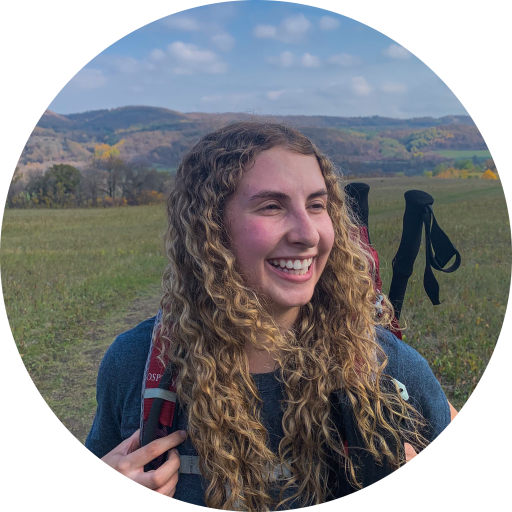
Mantario Hiking Trail
Mantario Hiking Trail is known to be the longest in the Canadian Shield area of Western Canada. It is located in Whiteshell Provincial Park. PR312 at Caddy Lake-South Trailhead; PR309 North Shore Big Whiteshell Lake-North Trailhead.

This trail is around 63km, however note that with route finding, it can be easy to get lost. My group ended with a total of 67.5km on the trail. At the time I hiked this, the trail was extremely overgrown, requiring lots of bushwhacking and navigation. In 2021, the trail was closed for several months due to wildfires. In 2022, the trail was closed again for a couple months due to flooding. This meant less people on the trail. Always leave a detailed itinerary with someone of your estimated time of return.

To stay on path, we followed the trail signs, cairns and flags. As a group, we would keep a lookout for those. If we kept walking without seeing one for a couple minutes, we would re-trace our steps until we could find one. This saved us several times, as it was tricky to navigate.

Now you’re probably wondering, how many days will this take me? This depends on you! There are trail runners that will run this in one day and some will hike this across several days. I hiked this in 4 days/3 nights, and thought this was the perfect balance. We hiked around 15-20km per day. We were still able to enjoy our mornings and evenings at the campsite. Again, the amount of days will depend on what kind of hike you are looking for!

This trail requires two vehicles, one parked at the North trailhead, and the second parked at the South trailhead. This also means you will need 2 Manitoba Park Passes. Some people will organize switching car keys on the trail, in order to avoid having to bring 2 vehicles.

Now which side should you start? North? South? It’s entirely up to you! I did South to North, knowing that the North side had some flooded sections. We knew and expected to walk through waist deep water, and decided we wanted to save that for the last day. I would also say the south section, starts of with quite a lot of ups and down, which is perfect for the first day with fresh legs. I don’t think I would of enjoyed doing the south section on the last day, as my legs and feet were exhausted.
Let’s quickly go through the Trail Amenities at each parking lot. North Parking Lot was rather small and there is no outhouse. South Parking Lot was very spacious, and did have an outhouse. Apparently there is a water well at the South end, however I’ve heard it has not worked for a while, I would not rely on this as a water resource.
You are in bear country, be bear aware and have bear spray on hand.
Gear to Pack
You want to bring the bare minimum, the essentials. I’ll list off what I packed and I can confidently say, I wouldn’t add/remove anything. Also, depending on the number of people you are going with, discuss who will bring what gear. I went with a group of 3 – so we only brought 1 tent, 1 cooking system, 1 water filter, etc. No doubles of anything that we could share.
Please note, this is what I brought-what you bring may differ from my list.

Clothing
I basically had a hiking/day outfit, and then a sleeping outfit. That’s all I wore. Depending on the weather, if it is colder – you may need a warmer jacket, tuque and gloves.
Hiking/Day Outfit
- Bra
- Underwear
- Shorts/Pants
- T-Shirt
- 2 pairs of socks (rotate each day)
- 1 pair of toe socks
- Hiking Shoes
Sleeping Outfit
- Long Sleeve Shirt
- Leggings
Extras Depending on Weather
- Fleece sweater
- Rain jacket
- Buff
- Toque
- Gloves
- Puffy Jacket

Equipment
- Tent (Footprint)
- Sleeping Bag
- Sleeping Pad
- Pillow
- Hiking Backpack (Rain Cover)
- Water Treatment Method
Cooking
- Stove & Fuel
- Lighter & Matches
- Utensil: I use a long spork
- Collapsible Bowl
- Mug
- Dish Cloth
- Dish Soap
- Bag for Garbage

Toiletries
- Toothbrush & Toothpaste
- Trowel, Toilet Paper, Waste Bag, Hand Sanitizer
- Wipes
Miscellaneous
- Two water bottles and/or Water Bladder
- Hiking Poles
- Camp Shoes/Sandals
- First Aid Kit
- Satellite Messenger
- Bug Spray
- Sunscreen
- Sunglasses
- Headlamp
- Portable Charger
- Books, Cards, Games
- Ear Plugs
Food
Probably the thing I look forward to the most, food on the trail! My advice is to pack a variety of snacks, and have a good breakfast & supper. For my lunches, I would have a variety of snacks. I packed all my food in a 15L dry bag, as each camp spot has a bear box. This is what my meals looked like on the trail, adjust accordingly. Remember to pack out all your garbage.

Breakfast
- Oatmeal: now I know oatmeal can be boring… I recommend adding some dried fruit, brown sugar or even buy pre-packaged flavoured oats or dino oats
- Dried fruit: mangoes, pineapple, apricot, blueberries, etc.
- Tea or Coffee
- Cold cereal: I love Prana Granolove, all you need is water, not even boiled

Snacks & Lunch
- Trail mix
- Corn nuts
- Candy/Gummies
- Variety of bards: Cliff Bars, Larabars
- Jerky
- Roasted peas/Fava beans from Three Farmers
- Babybel Cheese
- Fruit gummies
- Noun energy tabs

Supper
- Dehydrated meal: Personally, I love Mountain House, as they have 1 serving portions. Most other dehydrated meals will be 2 servings, which is too much food for me. However, my hiking buddies all had 2 serving portions for their dehydrated meals as they knew they’d have more of an appetite. What I also did, was packed my dehydrated meal in a freezer ziplock bag. The dehydrated meal packaging packs big – I’ve tested this, I was able to add boiling water into the ziplock bag, no issues. Saved me lots of room and garbage to pack out.
- Ichiban/Ramen noodles: absolute hit for the guys on this trip. They would eat this as a late night snack.

Campsites
There are 10 campsites along the trail. Each site has the following amenities: picnic table; fire pit; bear box; and basic toilet. The bear box and basic toilet are located away from the site. I noticed I’d find the bear box first, walk further down the path and then find the toilet. My tip is to find these when you get to your site, that way you are familiar with where they are and not searching in the dark for them. If you are not using the basic toilet, please use a trowel to bury your waste, 200 feet from water, campsite, trail. Please pack out your toilet paper as well. There are no garbage bins at these spots, you must carry out all your garbage. Pack out what you pack in!

From South to North, here are the campsites:
- West Caribou Lake (ideal for single overnight)
- East Caribou Lake
- Marion Lake
- Peggy Lake
- Alice Lake
- Olive Lake
- Moosehead Lake
- Mantario Lake
- Ritchey Lake
- Hemenway Lake (ideal for single overnight)

The Trail
I highly encourage you to purchase the Mantario Hiking Trail Map from Wilderness Supply. It’s a great resource that explains each section of the trail, distance, and is a physical map of the trail itself. I’ll explain each section of the trail based off the map from my perspective.
South Trailhead to Caribou Lake Junction
Distance: 7.2 km
This section is known to be one of the most challenging of the route. It’s known for it’s climbs and descent over the steep terrain of the Canadian Shield. Early on, there is a footbridge that crosses the Whiteshell River. I had heard previously it required walking through ankle deep water due to the high water levels, however when I went, there were plenty of logs to balance on, ultimately none of our shoes got wet on this section. During this section, you cross two sets of railway tracks, watch out for trains as they are both in use.


Caribou Lake Junction to Caribou West Campsite
Distance: 2.5km
West will take you to a one way overnight campsite. You cannot continue the rest of the Mantario trail going this way. This is ideal for people that want to go for a single out and back night. This would also be ideal to complete as a day hike. Certainly a good way to prepare to thru-hike Mantario.

Caribou Lake Junction to Caribou East Campsite
Distance: 5.1 km
You’ll want to head East if completing the entirety of the trail, this will take you to the East campsite. This may be one of my favourite sections of the trail, I call it the burnt forest. You hike through a section where wildfire burnt through the forest years ago. I can already notice the new growth, which is special to see. You eventually find yourself at the edge of Caribou Lake, which also happens to the the only time you cross into Ontario. Anyway, you’ll notice a steep scramble down, to cross a creek. Then, you’ll have to make your way back up. When I last went, there were two boats there, both looked abandon and not uses for years. You’ll eventually see a sign that indicates the turnoff for the campsites, if you’re camping here – follow that sign. If not, continue on the trail.


Caribou East Campsite to Marion Lake
Distance: 6.5km
This section was quite overgrown, as well you hike along granite sections. There is one and last set of train tracks to cross. You eventually reach Marion Lake, the perfect spot to camp overnight or to have a quick break by the lake before continuing the trail.

Marion Lake to Peggy Lake
Distance: 7.7 km
This section crosses your typical Canadian Shield, as well as you cross a beaver dam and pass some power lines. There are a series of jack pine ridges and intermittent streams.

Peggy Lake to Moosehead Lake
Distance: 6.3 km
From Peggy Lake to Moosehead Lake, you actually pass a couple of potential campsites such as Alice Lake and Olive Lake. Olive Lake has quite the descent, I suggest slowing down and taking your time. You then cross a beautiful wooden bridge.


Moosehead Lake to Mantario Lake
Distance: 8 km
This section offered some fantastic views from higher up, you’ll hike along granite ridges. Nothing new here, more climbs and descents on the trail.

Mantario Lake to Ritchey Lake Junction
Distance: 7.1 km
Again, the views from this section were unreal, you gain some elevation and are able to see the lakes within the Canadian Shield. And of course, there were lots of climbs and descents. You will eventually see a sign with the turnoff point for Ritchey Lake, if this is where you are camping, follow that trail. Otherwise you will continue to the next Lake.


Ritchey Lake to Hemenway Lake
Distance: 6 km
This section is a mix of gentle climbs and descents, as well as open open rock faces. You hike along the high ground of the west side of Ritchey Lake. Look out and be alert for the trail signs, as this section crosses some portage routes that are not part of the Mantario Trail.

Hemenway Lake to North Trailhead
Distance: 9.1 km
With the higher water levels, this is the section that will certainly get your boots and clothing wet! You hike along Big Whiteshell Lake, which offers some stunning views. I believe there are two wooden bridges at this section. One of the bridges was partially there, resulting in walking in below the waist level water. The second bridge must of been completely gone, which required us to walk through waist deep water. There is also an old rusty car on the trail – I have no clue why or who left this there. You also follow an abandoned ATV Trail for some time.


4 Day/3 Night Itinerary
Now I need to note, there are sooo many options when it comes on where to stop and camp each night, again depends on how many days you want to spend on the trail. This is what I did
Day 1 – South Trailhead to Marion Lake
Day 2 – Marion Lake to Moosehead Lake
Day 3 – Moosehead Lake to Ritchey Lake
Day 4 – Ritchey Lake to North Trailhead
Somethings to Note
- Trail conditions will always change, please use this as a guide to learn more about the trail however note that I went when high water levels/flooding were a concerns.
- Please check with Manitoba Parks if there are any trail closures.
- Bring an extra days worth of food.
- Highly recommend renting a SPOT satellite messenger from Wilderness Supply. They are affordable and a great way to check in with your contacts to let them know you are safe, or to utilize the SOS if in need of emergency assistance.
- Check the weather forecast and be prepared for unexpected weather conditions.

Happy Adventuring!
Excellent review and very helpful! thank you!
Thank you for sharing!
Your information and insight are greatly appreciated.
The trail appears to have a few changes since I last hiked it.
What percentage would you say the trail is through the recent burn?
Is there still lots of windfall trees across the trail?
The trail once was a wet monster to our group of 4. It rained every day. The trail was flooded and I/we were never dry … our feet paid a heavy price.
I love it when folks get together and share thoughts. Great blog, continue the
good work!
Nice post. I was checking constantly this blog and I’m impressed!
Very helpful information specifically the last part
🙂 I care for such information a lot. I was looking for this certain info for
a very long time. Thank you and good luck.